


Chased by the Storm
- Sep 17, 2018
- 8 min read
As we hiked the Blue Ridge Mountains, our attention remained focused on Hurricane Florence: where it would hit, when it would hit and what impact it would have. Mother Nature has been a tough mistress throughout our hike with heat, humidity, rain and flooding - but a Hurricane is certainly a new twist.

After a beautiful week in Shenandoah the weather regressed as we entered the Blue Ridge Mountains. While the rain offered some gorgeous effects it also fogged in many view points and made hiking more sodden. Still, better than a hurricane.
We initially planned to wait the storm out in Glasgow, but the hurricane was moving so slowly we decided to leave the comfort of the hostel in Glasgow and make a run for Daleville. Daleville is 56 miles away with a 4200 foot mountain in the middle. The hurricane is projected to hit Sunday and Monday with several inches of rain and high winds. We have just Friday and Saturday to cover those 56 miles. If we make it, we will hunker down in a hotel room in Daleville until the storm passes.
After an epic two day sprint we arrived in Daleville as dark fell Saturday night. It took a 32 mile day on Saturday, but we stayed dry and safe. The storm will pass by Tuesday so we will head back out on trail with McAfee Knob on the immediate agenda (one of the most iconic spots on the AT). Daleville is mile 1,462 for us, so we have completed 2/3 of this awesome adventure. We have just 729 miles to go; may it all be sunny ;).
Day 99 - we left Waynesboro on a misty morning with full and heavy packs after getting our resupply box. Today we hike up into the Blue Ridge and get close to 4K (but not quite there). After a satisfying 21 miles we settle in at the Maupin Field Shelter. The pervasive fog lingers seeping into everything.

Erik is his rain gear as we duck under the overpass to get back on the AT

There have been several unique trailside monuments. This was one of the more elaborate and immediately had us thinking of Rachel and the faerie houses she builds.

This cascade was spilling right over a fallen tree. The rain does create new cascades and falls for us to discover

This ruin was in the middle of the woods. A reminder that what is now woods was once something else that has been retaken by the woods.

Erik hiking through the Virginia woods. More switch backs here making ascents and descents a little easier.

Liked how these scallop fungus arrayed down this fallen tree

Can.just make out the next hill through the gloom

Have only seen this flower one time so captured it for our record

Scott atop Humpback Mountain. 3615 feet but no views past the fog :(

The rains swell the creeks and streams resulting in bigger, better falls and cascades

Normally trail like this would be awesome. However, on misty/foggy days water condenses on the plants and then floods your shoes as you hike by. Wet shoes are my biggest nemesis.

I took this picture so everyone can see who is in front . . .;)
Day 100 - Yes, 100 days done - Giddy Up! And to celebrate, we will climb the Priest today and summit another 4K peak. In fact, over our 21 mile hike today we will climb over 7,500 feet (and descend another 6,500) for one of our toughest climbing days on trail - thank heaven our trail legs have 100 days of experience;).

This morning the sun and storm battled for superiority creating stunning views for us from Three Ledges (3,967 feet)

Pictures cannot effectively convey the majesty we saw that morning

Rising above the fog in the distance is The Priest, our target for this afternoon

We captured additional views from Chimney Rock

Rainy night, wet gear, challenging climb - so worth it!

Erik's captured it from his perspective

Loved how this stream flowed right out of the tree trunk

Caught this last view before the storm won the battle

New flower falling across the path

Erik crosses a suspension bridge over the Tye River

Crossings are more exciting when streams swell (though getting water is easier)

By midday the storm won. Our views from The Priest and the overlooks were shrouded in fog. Disappointing but part of the experience.
Day 101 - more mist and rain drive us to a short day. After 14 miles we shuttle to Stanimal 328 Hostel in Glasgow. Virginia from the Route 60 trail head. We will hub out of this hostel as we manage the impact of the storm - sheltering as necessary while also trying to manage some miles to stay on schedule.

Erik hikes across Cole Mountain Bald, a meadow at the top of a 4000 foot "hill"

Can you see the blaze out there? Was tough navigating through the persistent fog

This six foot black snake was crossing the trail just as we happened by - he was well fed and much thicker than most we have seen

Erik captured this one during our hike today

Wandered by this huge tree - if it could talk think of the stories it would tell

The rain on the spider webs looks like diamonds but there are so many spider webs (especially across the trail) it feels like Shelob's Lair.

Not sure why this dinosaur is in Glasgow but we knew Rachel would love it.
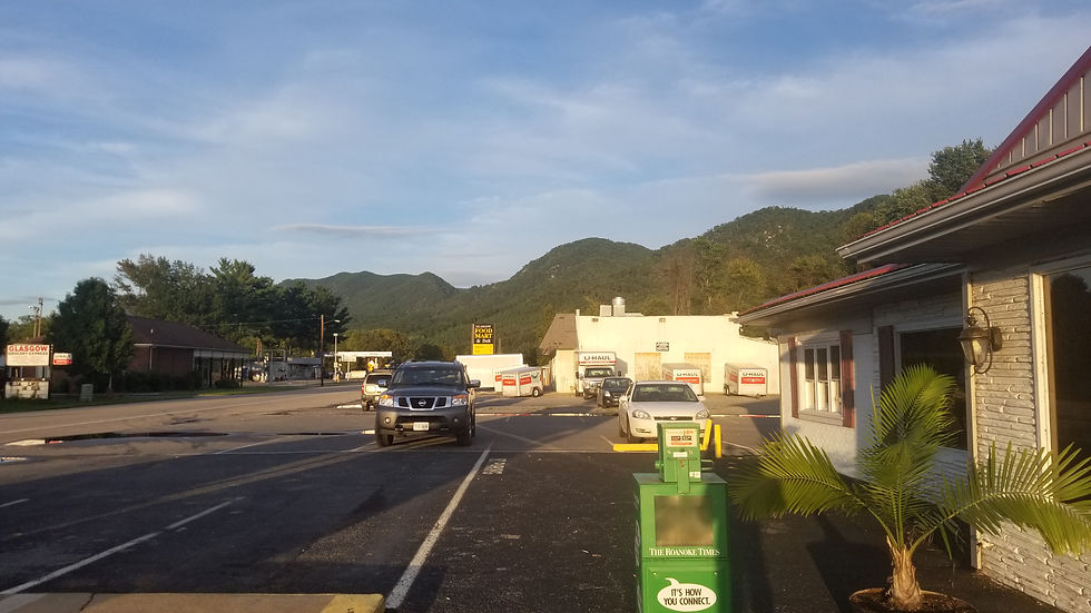
Scotto's is the only restaurant in Glasgow (good thing it was tasty and affordable). The AT passes through the mountains behind
Day 102 - after a pancake breakfast we shuttled back to Route 60 to start our day. We hiked 22 miles to the James River Footbridge and then went back to the hostel in Glasgow. Today was the calm before the storm as it only rained for an hour and was actually sunny most of the day.

We started the day hiking along Brown Mountain Creek and end the day hiking along Rocky Row Run. Hiking is somehow easier and more enjoyable when water is running beside your trail.

Erik demonstrating a rock hop to cross the stream

There is a bright green color when bright sunlight hits the tree leaves - a rare sight for us though I love the color

Erik a swithback above me. While not found north of the Mason-Dixon line, switchbacks are more common in the South lengthening the trail but mitigating the grade.

The Lynchburg reservoir dam, there is some concern the rains from Florence will cause this dam to fail :(

Forest Service posted these AT Trail closure signs. They always appear on the Northbound side so until told otherwise, we assume Southbound is still open (??)

Erik finds another interesting bug

The trees here are uber tall with no limbs until near the top

The sun shining the a group of those tall top heavy trees

A large road we shared the trail with today

Erik at the top of Bluff Mountain (3350 feet). No real view so the fog was not a big problem.

We posted this same snow like moss on our first day in Maine and saw it again 100 days later in Virginia.

Scott, on top of a rock, on top of Little Rocky Row

Tomorrow we climb Apple Orchard Mountain (4,230 feet). Today it is shrouded in clouds.

Looking down on the James River from Little Rocky Row

This picture captures the battle line between the rain in the valley on the right on the sun in the valley on the left.

More Shelob! This spider web was huge (looks like it caught a bat)

Sunny in the valley while the clouds fight to cover the mountain tops

A beautiful view of the James River valley

Apple Orchard Mountain breaks free of the clouds. Today, the sun gets a rare win

Erik enjoying the sun soaked trail as we descend into the valley

The Rocky River Run that followed us down the valley to the trailhead

Shelob! This monster's web was across the trail and she almost landed on my face - exciting moment for both of us

Erik enjoying a break at the cliffs overlooking the river below
Day 103 - we start our run for Daleville by eating a big breakfast (omelet and pancakes) and getting an early start on a long day. We hike almost 25 miles to Bryant Ridge Shelter (one of the largest on the AT). The rain started falling 10 minutes after we arrived and kept falling all night. Was great to be dry in a shelter.

We start the day taking the Foot Bridge over the James River (named after a guy named Foot and also a foot bridge)

Found this trickle falling down the rocks

We hiked by Lynchburg Dam yesterday and today we saw it from across the valley (shows how far we progressed in a day)

No time for side trips today but Devil's Marbleyard sounds like an interesting venue - next time

After 100 days we have developed instincts. When the canopy opened we knew the trail would turn up this climb (if it goes up, the AT goes that way)

Erik atop Highcock Knob (3,054 feet)

Flower of the day

Shelob dangling over the trail

Thunder Ridge Overlook- with all this infrastructure the view must be awesome . . .

Skyline Drive wound through Shenandoah and the Blue Ridge Parkway winds through here

The AT heading off from the Blue Ridge Parkway at Thunder Ridge Overlook

The Guillotine on the way to Apple Orchard Mountain

After a healthy climb, we get to the summit of Apple Orchard Mountain (4,225 Feet - haven't been that high in a while)

There still some apple trees on the mountain though the apples looked a little rough

View from Black Rock Overlook

This blow down was so big we had to go around

The Bryant Ridge Shelter, sleeps 16 but we had it all to ourselves
Day 104 - Florence is expected to dump 2-6 inches of rain on Sunday/Monday and the winds can blow down trees so we need to get to town. That means hiking 32 miles to Daleville today if we want to be safe (and dry). We were up at 5:30 getting an early start and were blessed that the rain diminished minutes after we left the shelter. In addition, the trail was great today (smooth with gentle grade) so we had good conditions to make the rub. The farthest we had hiked was 28.5 miles, so 32 miles in a day was going to be a stretch. We kept a 2.5 MPH pace throughout the day, ate more than 3,000 calories to stay energized and arrived in Daleville just as full darkness fell. That completes a 56 mile sprint over two days: but we are out of the storm and have two zero days to rest and recover.

A log staircase leads up the hill

Still love hiking through the mist but after a week it is wearing thin

Scott and Erik depicted as stick hikers

An actual view at Buchanan bodes well for the weather today

Erik snapped this view of Mills Gap along the Blue Ridge Parkway

This is the view from Peaks of Otter Overlook. We crossed the BRP six times today at various overlooks

The storm slowly takes over as the day progresses. We hurry our pace to get to town before dark and rain overtake us

The views sometimes extend along both sides of the Blue Ridge Parkway like at this overlook

A hiker left these unicorn pictures everywhere along the trail. In shelters, on signs, in pipes and privies. Imagining how much time they spent drawing all those unicorns - added a week to their hike.

So many views today, but all shrouded in the growing cloud cover

A look.down to the valley we are racing toward

We had afternoon break (second breakfast) at this table with an amazing view at Montvale Overlook

View of Taylor Mountain from another BRP overlook

Cool walking stick enshrined at the Wilson Creek Shelter

These stocks have just enough room for a hiker with a backpack to waddle through - but not a bike.

A collection of mushrooms at the Fullhardt Knob Shelter (don't eat them)

Looking back on Fullhardt Knob after we climbed down toward Daleville

The lights of Daleville a mile away as we finish our 32 mile run and darkness falls

Loved the color and contrast
Days 105/106 - we hide from the storm in Daleville as 5 inches of rain fall Sunday/Monday and winds are up to 25 MPH. Tough to sit idle but good to let the feet, knees and body recover a little.

The storm clouds of Florence over Daleville on Sunday morning

Are blue sky by Monday night, so . . .
We are excited to get back on trail Tuesday morning. Blow downs and swollen streams are still risks from Florence but we look forward to seeing McAfee Knob and more of Virginia.
Next update will be in about a week to ten days from Damascus.
Comments