


The incredible McAfee Knob (and other Virginia highlights)
- Sep 27, 2018
- 8 min read
After Florence passed we left Daleville and immediately experienced iconic AT venues like McAfee Knob, Dragons Tooth and the Keffer Oak; we were excited to be back on trail.

While sheltering from the storm, we figured out the spider situation. It isn't that there are more spiders here it's that there are fewer hikers. When we were up North there were many NOBOs passing us daily and other SOBOs and day hikers. They would clear all the spider webs before we got there. Now, the NOBOs are all gone, the SOBOs are mostly behind us and the weather kept the day hikers away. We are pretty much alone in the woods so we hit all the spider webs on the trail. May seem obvious but took us a while to figure that out. We were sure the spiders were taking over Virginia.
McAfee Knob was one of the highlights of our trip, but the stretch afterward was physically and mentally challenging. The weather was dry (thank heaven) but hot and humid which drains our energy. The trail also was tougher over this stretch (rocky like Pennsylvania) which impacts my joints. When we started four months ago, my knee was the biggest risk (all that running had destroyed the cartilage). Surprisingly, the knee gave me little trouble for the first 1500 miles. It would scream every once in a while, but then quiet down again. This past week, my knee hurt every day without quieting back down. Not sure if it was that 32 mile sprint to Daleville but something is different. Taking vitamin I (Ibuprofen) to mitigate the pain but find that by late in the day the persistent ache wears me down mentally. We need to hike about 20 miles a day to finish on time. Before the storm we were averaging 24 miles per day and I was confident. Since returning, we are averaging 18 and feeling beat; that has generated some doubts. We took a few shorter days and several hostel stays which improved the situation. The rain also brought cooler temperatures (the heat was dehydrating and draining us). Despite all these changes, the best solution continues to be daily and preemptive doses of Ibuprofen :).
Fall is officially here as well, hoping that leads to cooler temperatures and LESS humidity. Also looking forward to fall foliage on Clingman's Dome and other peaks down south.
We have less than 75 miles of Virginia left so the next update will be coming from Tennessee (state number twelve). Until then, think dry and cool weather :).
Day 107 - today we climbed McAfee Knob, the most photographed spot on the AT (and we can see why). After relaxing in the sun on McAfee for a while we hiked a few miles to a new shelter called John's Spring (19 mile day)

We met some section hikers at the Shelter last night

No flowers today but a beautiful fungus

Looking down on Carvin Core Reservoir

A good shelter from the storm, though today is a sunny day

We took our break at this well equipped camp site by the creek

Erik looking over Hay Rock (1946 feet)

View from Tinker Cliffs (2953 feet)

Tinker Creek from the Ledges (2274 feet)

This mushroom is both big and tall, on a skinny little stem

Scott on the cliffs approaching McAfee Knob

Erik enjoys a break at the cliffs

The full view from the cliffs

Erik on McAfee Knob (3117 feet)

That is as close as I get to the edge ;)

Looking down from the edge of McAfee Knob (okay I got a little closer)

The dynamic duo enjoy some time at the most iconic spot on the AT

Panorama of McAfee with Erik on the edge

The panorama from Tinkers Cliffs

The view looking back toward Daleville

Scott takes in some sun and enjoys the panoramic view from McAfee Knob
Day 108 - a tougher day as we tackle 21.3 miles while also climbing the Dragon's Tooth. We stealth camp and get into camp near dark.

It is amazing how these trees survive growing on rocks

Enjoying a rare sunny day

They built this stock so tight our backpacks could not fit through :(

I thought this was Dragon's Tooth, but it is just a cool camp site

The trail was more difficult today (more like NH)

This is Dragon's Tooth!

The view looking down into the valley

Erik atop the Dragon's Tooth (I lacked the energy or courage to join him)

Here is the view Erik had at the top

And what it looked like looking down to where I was safely standing

I always show panoramas of the mountain tops but we spend most of our time in the woods so I include this to give a sense for what it's like to be surrounded by trees

We passed 1500 miles today! Giddy Up!
Day 109 - another 20.6 miles took us to War Spur shelter. We passed Kelly Knob and the Keffer Oak (largest oak on the AT). A long day with little reward (hard to follow McAfee Knob and Dragons Tooth).

Did you know the East Coast has a continental divide? We just passed it :)

Thought this rock looked like a Lions head in profile

The Keffer Oak. Over 300 years old and the largest on the AT

Glad we are not staying at this shelter;)

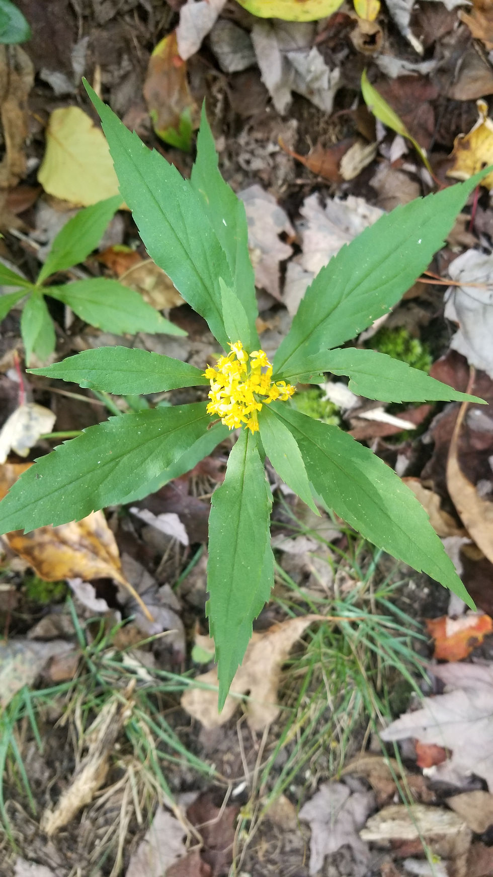
A new flower

Fields and Meadows were hot today in the sun (but dry :))

We hike past Virginia Farms

This creek was the last water for over ten miles, glad it was flowing well

The view from Kelly Knob

Given Halloween is coming up, thought this tree was fitting

The rocks at Kelly Knob took some jumping as there were wide and deep fissures
Day 110 - early today we crossed a 3 mile section of wet moss covered rocks. I fell hard and twisted my knee (cursing the Roanoke ATC as I fell :) and the section took us over 3 hours to cross. Luckily the trail improved later in the day and we were able to finish 19 miles and find a sweet stealth camping spot along the top of the ridge.

Hoping to see these again when they fully bloom

At first we thought a bear had eaten someone's orange M&Ms. When we were brave enough to pick it up, it turned out to be a seed pod.

These are new

So many different fungi on this one dead tree

Erik relaxing on the cliffs, sunny weather and higher altitudes make for better views
Good day for flowers and thinking of home

A plinth marking Dickinson Gap (3310 feet)

Our camp atop the ridge with a cool breeze blowing and dinner cooking
Day 111 - a shorter day (much needed) as we hiked 13.2 miles off the ridge and down to Angel's Rest hostel in Pearisburg. We passed a beautiful view and cool shelter on.the way where we took a pop tart break.

Remnants of old apple orchards are atop many of these Virginia mountains

View from the ridge line as we hike off the peak toward Pearisburg+

The panorama from Peter's Mountain Ridge (3353 feet). With full zoom you can see me waving from Rice Field Shelter.

17 MPH? It's okay, we hike about 2.5 MPH.

This innocuous looking plant . . .

Leaves your leg and sock looking like this :(. Does not hurt but is annoying to constantly remove them

A welcome rest indeed, been a hot and difficult week so far (with another 55 miles under our belt).

Erik gets his wings

And I get mine
Day 112 - rained hard last night (good to be in a hostel) and calls for rain through next week :(. We watched The Two Towers Extended Edition last night so were up late and got off to a late start. A short 11 miles takes us to the famous Woods Hole hostel were we will shelter tonight. Hoping the short day will help my knee improve.

Iconic AT signs

These power lines above the trail were only 7 feet above ground - scary

The approach to Angels Rest

Erik on Angel's Rest (3,507 feet). While it is disappointing to have some views fogged out we are blessed to have sun on McAfee Knob, Dragon's Tooth and all the other iconic places we have seen.

In this part of Virginia, the woods are overrun with rhododendrons. They form these tunnels that are filled with fog, wet branches and often little streams where the trail should be

In.fact, everything is wet here. Check out this shelter sign

Erik on the front porch at Wood's Hole Hostel (and in heaven between the two guitars).

Liked this little mouse door in the hostel

Wood's Hole Hostel in the fog
Day 113 - after a few shorter days we got back on schedule hiking 21 miles to Lickskillet Hostel. It didn't rain today (thankfully) but did rain all last night so the trail was a creek in several places and the plants were wet. We broke the day up with a few side trips as today's hike was pretty gentle.

Erik on Sugar Run Mountain (4,022 Feet!)

When the Hurricane came through it blew down all the fall leaves :(

Had to share this bizarre mushroom (hard to find flowers on rainy days but fungi are plentiful)

Scott in front of Dismal Falls. Flowing well with all the recent rain

This suspension bridge took us over Kimbetling Creek

Erik in the "Pirate Bed" at Lickspittle Hostel
Day 114 - we are trying something new today, slack packing. That is where we leave the hostel with just a day pack and the hostel owner meets us down trail with our full packs. It is quite a popular option but one I initially said I wouldn't use (wanted to be a purist). With my recent knee issues, decided to try it once and see if it makes a difference. Better to enjoy and finish than be a purist and blow up before we get to Georgia. We will hike with day packs for the first 20 miles and then pick up our full packs for the final 4.5 miles to Jenkins Shelter.

Not sure what makes these massive webs (doubt it's a spider and not tent worms) but this one had an awesome geometric design

Not a flower but a cool little plant with an intricate leaf pattern

Erik and I had lunch at the Brushy Mountain Outpost (deep fried tenderloin sandwich was delicious) and this was our view

Awesome stealth camp site near the summit but with rain coming we had to push through to Jenkins shelter

A red maple leaf brings color to the trail

Hiking through the "snow" which is in reality a field of flowers gone to seed

A view of the flower up close

Another beautiful fungus growing on this dead log
Day 115 - well the slack packing experiment was educational though not overly beneficial. It turns out we did not hike much faster or farther even though the packs were lighter. And while the impact on my knee was mitigated, I still had to take Ibuprofen. So, today we returned to full packs and hiked 22 miles in 9 hours (faster than when we slack packed). It was another rainy afternoon so we are happy to be spending the night at the Appalachian Dreamer Hostel. The owner made us a great dinner of home grown vegetable soup and fried bologna sandwiches. Gotta love the South.

A stone stairway descends from a rock crevasse

A soggy Scott at the Chestnut Hill Shelter. An old fire warden's cabin converted to a hiker shelter on Chestnut Hill (4,400 feet - getting higher :))

Fall fell all over the trail.

The Appalachian Dreamer Hostel run by a 2000 Miler from 2006. Made us dinner and breakfast - a nice break from the rain.
Day 116 - more rain today as we hit a major milestone; today we completed three quarters of the AT (1650 miles). We are excited to be so close, though still have some cool sites to see. With all rain we took a short day and tucked into the Relax Inn after just 13 miles and a jumbo burrito lunch.

Our day started hiking across overgrown meadows and fields - wet work on a rainy day

The flood water sign shows how high this creek can get - low enough we could cross on the road today

Erik heading across more fields- this 14 mile section of the AT runs across easements on private lands, most of which is farm land

We have seen many memorials along the AT. I liked the practicality of this one

Thinking of home and those there

Jumbo burrito special for lunch as the trail crossed Marion, Virginia

The cows were mooing like crazy when we hiked across their paddock (watch out for all those pies)

An old covered bridge near the Relax Inn where we sheltered from the rain
Next stop, Tennessee - talk to y'all in about a week.
Comments