


Basking in Tennessee's Amazing Roan Highlands
- Oct 8, 2018
- 11 min read
After a month of hiking, and 540 miles, we finally leave Virginia and enter Tennessee and then North Carolina (we actually hike along the North Carolina/Tennessee border for about 400 miles). These are states twelve and thirteen out of fourteen which reminds us we are almost done.
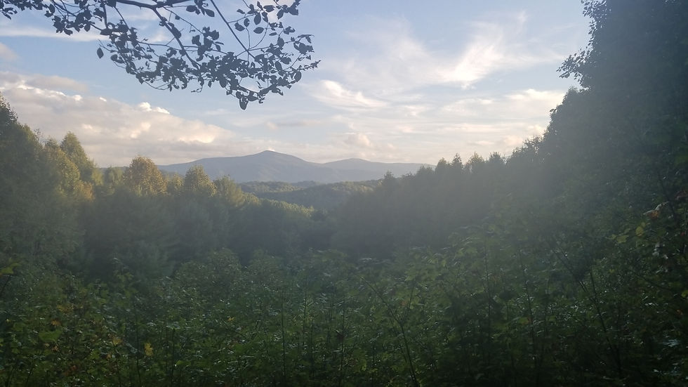
The trail and weather both improved as we entered Tennessee and we are finding hostels available almost every night. The ground is rising as we climb south leading to improved views and cooler temperatures. I am liking all these trends.
In addition, a trail angel that Erik met at the Shamrock Inn back in Dalton, Massachusetts is supporting us for four days between 19E and Devil's Gap. That means sleeping in a bed, eating real food and a hot shower each night - all welcome this late in the game. The support comes at a critical time as I have infections in both feet and a bruised and blistered right heel. Normally these issues would sideline me but the daily support allowed me to heal while still making miles each day. We have our share of challenges, but continue to be blessed with timely solutions.
As a result, the miles are flying by quickly. We hit our 1700 and 1800 mile marks, leaving just 311 miles to Springer Mountain and our finish.
We have 20 days to hike those miles and return home on schedule. For the math majors out there, that is just 15 miles per day! Here is to finishing strong!
Day 117 - a sunny day! We hike 21 miles to the Trimpi shelter. This is a stone shelter with a fireplace and we have it all to ourselves. We got an early start and kept a good pace so arrived with plenty of time to set camp and make dinner.

Looking back on the Relax Inn where we hid from the rain

We passed the Settlers Museum before they opened but did see this cool old schoolhouse

Erik was rocking and rolling on this log as he tried to cross the stream. I fell into a stream later in the day when my branch bridge gave way one foot from the bank

Clouds shroud the peak on our view of Walker Mountain

Virginia does not sign most peaks but someone added a home made one for Glade Mountain (4,093 feet)

We took a break at Partnership Shelter (it is the only shelter we saw that had a shower

The stocks get creative - this one from fallen trees
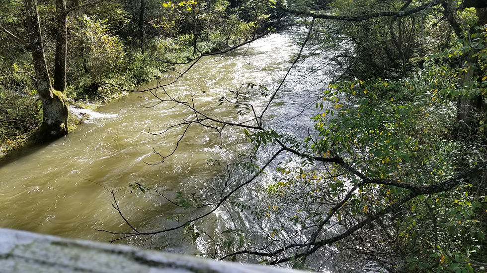
Passing over a swollen trout stream

A lively cascade feeding the trout stream

We end the day hiking across well groomed meadows
Day 118 - today we hiked across the Grayson Highlands, a beautiful set of fields at 4000-5000 feet where long horn steer, horses and wild ponies graze. The USFS has panicked about human/bear encounters so they closed a 17 mile section to over night camping. That threw a wrench in our plans so we hiked 22 miles to Massie Gap and had a shuttle take us to Damascus for the night. They will take us back to Massie in the morning so we can resume our hike. Today was sunny but the trail remains wet (like a creek in several places). The creeks are swollen and I spilled into one. Made it most of the way across on logs but with about a foot left a log broke and I got wet. Cleaned my shoes off at least.

These ones were open a bit. Still have not seen one in full bloom

All the rain has the waterfalls at maximum volume - they sound awesome

Trail Art

More artistic fungus

This group of horse back riders at Grayson Highlands reminded me of our family rides with Cowboy Mike in Brian Head.

This tree root formed into a perfect spout

Many different trail markers, these in Mount Rogers are the most clear

Erik found a wild pony at the trail peak (4,900 feet)

Good grazing up here

The view back from Grayson Highlands

A great privy at the Highlands became our afternoon break spot (amazing how you gain an appreciation for simple things like a privy)

They graze Longhorns up in these Highlands
Day 119 - After being shuttled back to Massie Gap we hike a huge 33 mile day that included Mount Roger's (the highest peak in Virginia), walking the ridgeline, hiking part of the Virginia Creeper Trail and finally hiking through Damascus and back to the hostel. We hiked the last hour and a half with head lamps but arrived at Woodchucks Hostel by 8:30.

Our morning started with wild ponies in the mist

This one wanted a snack, we had too disappoint him

Heading up Mount Roger's took us over some interesting terrain

The peak of Mount Rogers (5,729 feet) and this survey marker is all that is up there to mark it

Standing atop Mount Rogers

A gorgeous new flower found on the way down

Fields and rocky outcroppings mark the way down

Looking down the Mount Roger's descent

Another bright new flower just as we approach the Tennessee border

The AT merges for a while with the Virginia Creeper Trail (a cool bike path along Laurel Creek)

We spotted this Halloween caterpillar late in the day with black fur connected by little orange sections

A 33 mile day ends with a little night hike into Damascus, Virginia and back to Woodchucks Hostel

View from the rocky outcropping

View as we descended through fields from Mount Rogers
Day 120 - welcome to October, our final month. Today has a late start as we chase down our resupply box. That's okay though since after the monster day yesterday we plan to hike just 18.5 miles to Double Springs Shelter. We climbed out of the valley from Damascus and enjoyed a dry night in our tents (has been a while and we loved getting back into our "sanctuaries".)

As I walked Damascus getting our resupply and new pole tips, found this AT sidewalk and as a SOBO appreciated the Maine to Georgia message. (Lumpy at MRO put new tips on and would not accept payment - good guy)

This is NOT Woodchucks but was close by and a gorgeous Victorian - loved it

Most NOBOs see this as they enter Damascus, we saw it as we left.

We enter Tennessee - our twelfth state out of fourteen. We were in Virginia for almost a month (540 miles) so a feeling of progress as we exit

Found this fungus to be interesting

Sometimes water sources are small. We find the water is actually better when we get it near the source like this little spring near Double Spring Gap (3,850 feet)

We appreciate the beautiful, well maintained trail in Tennessee (and the sunshine)
Day 121 - Hiking 23.5 miles takes us to Hampton, Tennessee and the Boots Off Hostel. While there was no rain, the day was misty and damp. We pushed hard to get there by 6 PM so we could catch the shuttle = Subway for dinner. We stayed in a quaint little mini-cabin that had a bunk up top and a double below. The long days are made easier by the good trail in Tennessee.

This calf had me thinking of Rachel
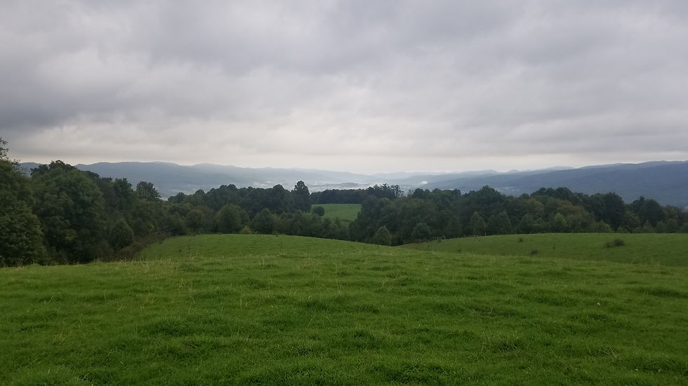
Tennesee farmland leading to the mountains

Only the government would make a trail gate ADA compliant. Wheelchair couldn't get to the gate but could open it . . .

Panorama of the pastures surrounding the trail

This is the grave of the famous hermit Nick Grindstaff who died in 1929. Great story but too long to relate here

Day glow fungus in the sun

Looking down at Roan Creek (feeding Watauga Lake)

I thought the term "lingering" was curious. What constitutes lingering? We did not see any bears (or any lingerers)

Looking down at Watauga Lake and Dam

Panorama from the middle of Watauga Dam


Thought this drop on the far side of the dam would make an awesome frisbee golf hole (had me thinking of my brother Dave)

This is a new flower for Tennessee

As is this pretty one
Day 122 - another 21 miles up and Pond Mountain, down to Laurel Fork falls and then back up to 4000 feet before arriving at Scotty's Five Dollar Piano Bar and Hostel. Erik ended up playing the piano (and guitar) but the $5 was accurate. Over 7000 feet of climb today (puts us over 400,000 of ascent so far). Was tiring, but another short day tomorrow.

We stayed in the green mini-cabin at Boots Off Hostel. It had a double bed down, single up, a mini frig, fan, power - was comfy and well designed.

Looking back on Watauga Lake. We were just down there this morning. Healthy climb to start the day.

Yet another AT signpost design, each state seems to have their own.

Thought I found a ripe peach, turned out to be a colorful toadstool

Laurel Creek Falls - they were amazing, reminded me of falls in Yosemite

Coming up from the falls we climbed hundreds of stone steps (like climbing to Cirith Ungol)

Nice the trail in Tennessee goes between the rock piles instead of over them like Maine and NH

This cabin has seen better days, will not be sheltering here tonight

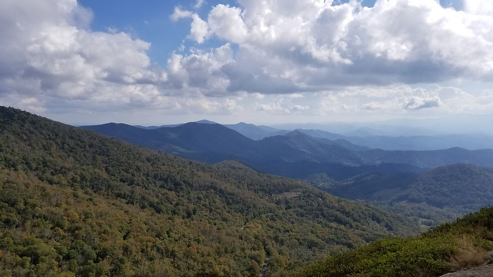
Seeing these 6000 foot+ mountains on the horizon reminds me of The Whites in New Hampshire. Excited to get some altitude and cooler temperatures as we head into the Roan Highlands

There was a bench at just the right spot on the trail where this gorgeous view of Roan Mountain appeared. We sat for a while and savored before hiking a side trail down to Scotty's $5 Hostel and Piano Bar
Day 123 - a quick 12 miles takes us to Roan Mountain, Tennessee where a trail angel Erik met in Massachusetts will meet us and support us over the next 80 miles (four days). This means sleeping in a bed, getting a shower and fresh food for the next four days ;).

We passed this small but almost perfect for ring. A hiker with an artistic bent (or OCD) took a lot of time finding and fitting the right stones together

406 miles to Springer - getting close and feels like the miles and days are passing by faster

We had second breakfast at the Mountaineer Shelter, a triple decker shelter.

The Mountaineer Falls were a little disappointing given the low water volume. An acceptable trade off for a few sunny days on trail.

Our hike took us along the Elk River

Where we found fields of wild flowers including a few new ones

This beauty was down by the riverside but looks an awful lot like the flower from yesterday

Jones Falls were impressive and worth the hike down the side trail

Loved the etching on this toadstool - a way for mages or elves to leave messages?

I love these old forest sections of pines where the trail is covered in pine needles that cushion your steps and the air smells so clean and crisp. They are rare along the AT but I enjoy them when we find one.

Our hike finished with a jaunt across some Tennessee fields

That became more overgrown as we descended
Day 124 - with the support of Rob, our trail angel, we hiked 21 miles to Hughes Gap with climbs to Hump Mountain (5,558 feet), Little Hump Mountain (5,446 feet), Grassy Ridge Bald (6,165 feet), Jane Bald (5,807 feet) and Round Bald (5,826 feet). Most height since the Whites - Giddy Up!
A lot of pictures but still didn't fully capture the grace and beauty of the Roan Highlands.

Rob, our trail angel, with his Casper van drop us off at the 19E trail head

This is a NOBO sign so we are actually entering North Carolina, our thirteenth state

An early view as we climb Hump Mountain

We passed mile 1800! Our time in Maine feels like a lifetime ago as we push toward Springer.

The panorama as the bald opened up on the way to Hump Mountain

Erik relaxing as we sit atop Hump Mountain

We waited for the clouds to blow past and the sun came out for this panorama on Little Hump Mountain

Looking forward to our next climb

It is cool to see the trail wind through the bald. We are so used to being under the canopy, we love these open spaces

Included Erik in this one to provide perspective on how big and open these balds are

It never rained but the clouds kept blowing across the balds

Big trail marker keeps us on course

Looking forward to Roan Mountain - over 6000 feet and our final climb of the day

Peeking out a knot hole in the upper deck at Overmountain Shelter

The view from the porch at Overmountain Shelter, a huge barn type shelter that sleeps 30+

The trail in Tennessee/North Carolina continues to be idyllic (the trail I imagined before starting on this journey)

A .6 mile side trail took us to Grassy Ridge Bald (6,165 feet). Extra miles on a long day but so worth it. Loving these high balds.

Looking forward to Jane's Bald with Roan Mountain in the background
View from Jane's Bald (5,807 feet)

Looking back from Jane's Bald toward Hump and Little Hump

Looking into the valley West as we climb Round Bald

View from Round Bald (5,826 feet)

Our daily flower

Each shelter has a log book where we note our arrival. We also keep track of trail friends by tracking their entries. This is Roan Mountain Shelter at 6,204 feet the highest shelter on the entire AT.

Not a lot of explanation for this but assume it is part of the old Cloudland Resort. Now just a big fireplace sitting aside the trail.

In the late 1800s they built a huge resort up here called Cloudland. Guests had to hike up but when they arrived, they were treated to luxurious accommodations. Such a beautiful area, can see why they built here. Nothing left now but some footings.
Day 125 - another sunny day as we hiked 22 miles over Iron mountain and Utaka Mountain (5,505 feet). Not as much too see today so we ground the miles and finished by 4:30. AYCE Chinese for dinner than a little guitar playing for Erik before soaking the feet and hitting the bunk.

An early view from Iron Mountain

A bright fungus in the sunlight

This flower has a purple hue that wasn't fully captured by this photo

The trail followed the Doe River along this bright meadow

We took a break atop Utaka Mountain (5,505 feet). No view but the summit was dominated by a gorgeous and deep pine forest.

A panorama of the Utaka Mountain summit. All pine trees and moss except where the trail winds through- was awesome.

This beauty was deep in a berry patch. Risked thorns and ticks to get this shot.

We ended the day at a place called Beauty Spot - for good reason. A splendid view to savor.
Day 126 - today we hiked 19 miles up and down Tennessee mountains and across the Nolichucky River. While it called for rain, it stayed sunny (yea for a dry October) but today was one of those where you just grind the miles. I find that after huge and gorgeous days (like McAfee Knob or the Roan Highlands) the next few days are usually anti-climactic and thus harder. Looking forward to a better day tomorrow.

Looking down toward Erwin, Tennessee and Uncle Johnny's Hostel where we took a quick break

A great view of the Nolichucky River below

This toadstool looked like a shiny clam shell

We ran across a group of bear hunters during today's hike - they use hounds to track the bear.

The trail down here has great stealth sites all over the place.

This tree trunk was literally decimated with holes - you can see right through it.

Yet up above the tree seems just fine. Clearly the tree only uses its outer core to survive and the middle is all optional.
Day 127 - a 22 mile day with a grade of 554 feet/mile (highest grade since we did Dragon's Tooth). This is the last 20+ mile day we need to pull before we finish so looking forward to getting it done. This is also the last day we get Rob's support. Starting tomorrow, we are back on our own.

Erik adjusts his shoes as we start the climb up Big Bald

On the way up we passed a bird research and tagging station. We were hoping to see hawks or eagles

But instead saw them tag a black throated warbler

After tagging they release them back into the wild

The approach to Big Bald

An awesome stealth camp site at the top of Big Bald (5,505 feet)

Looking back toward Little Bald and the trail we took up

The adventures atop Big Bald

The view from the bald was 360 degrees

This dog was huge (but friendly)

Sometimes the best views are behind you. That is Big Bald now behind us.

There were seven Monarchs all on this same bush

A side trail hike offered this view.

And this view ended our day.

Most days end with the trail dropping into a gap, usually via switchbacks. Hard on the old knees but up and down are the nature of the AT.
We are back on our own tomorrow (no more support) and are just five days from entering The Great Smokey Mountains. With just over 300 miles left, we will likely have only 2-3 more updates. Our next update will come from the Smokies. Until then.
Comments