


Smoking through the Smokies
- Oct 18, 2018
- 7 min read
We enjoyed a few more days of good trail and good weather through Tennessee before hiking into Hot Springs, NC. This is the gateway to the Smoky Mountain National Park. In Hot Springs we obtained our permits at the outfitter and had a delicious dinner at the local diner. The Smokies bring us the biggest mountains since the Whites and we were excited to get up there. The weather turned on us, however, as it turned cold, wet and foggy. As a result, there was less to see so we moved more quickly.
We passed 2000 miles (WOW!) and our focus shifted toward finishing. With less than 200 miles to go we are savoring each day while also growing excited to be done. Our hard work over the past two months means we need to average just 15 miles per day and we will hit Springer Mountain on October 28. Hard to believe so much time and so many miles have already passed by . . . hard to believe we are almost finished.

Day 128 - back to full packs and a twenty mile day but nice weather and reasonable grade made the day easier. We ended the day at mile 1900! Giddy Up.

Our Trail Angel, Rob, drops us off for the last time. We enjoyed five nights of sleeping in a real bed and eating real food while still making miles thanks to Rob.

This double blow down was a hassle to hike around this morning

An early view into North Carolina from Big Butt Mountain (4,810 feet)

Only 300 miles to Springer - getting excited

Hard to believe this tree is still alive, but it is

A panorama from Big Firescald Knob (4,531 feet)

The trail on the bald was more like Maine than Tennessee

Stood on a rock at the top to get this 360 degree view

Looking down into a NC Valley

We end the day at mile 1900! Hard to believe we have hiked that far.
Day 129 - after a comfortable night in the Hemlock Hollow Hostel (so many hostels makes this southern section more humane ;)) we hiked 16.4 miles on a more challenging grade to get into Hot Springs. NC. We went to the outfitters for our Smokey Mountains permits (excited for the Smokies), had dinner at the diner and checked into Elmer's Sunnyside Inn.

A bat house down by a pond - we like bats since they eat the mosquitos

Looking down into Hot Springs

After a long hike it is exciting to see a town.getting close

We cross the French Broad River on our way into town

Steep cliffs as we hike along the river bank

Hot Springs is an AT Trail Town where the AT runs directly through downtown
Day 130 - we hiked out of Hot Springs on a rainy morning as Hurricane Michael swept through. We had a great breakfast at the diner before leaving and the rain stopped by mid-morning.

A cool AT Centennial memorial early in the day. We hiked 18 miles UP hill. Towns are down so the day after hikes are always big climbs.

The day was a little murky as we took a break at Walnut Mountain Shelter. Look close to see Erik in there. Wet day so not many pictures. We stayed at Roaring Fork Shelter so we could get a jump on Max Patch in the morning.
Day 131 - we hiked 16 miles and arrived at Standing Bear Farm, a popular hostel and we understand why. Lots of trail magic. First, they gave us a pound of ground venison which I made into delicious burgers. Then they had a movie night and served grilled pork, guacamole and lots of other food. Was awesome and a great way to end the day.

The day looked promising as we started early

However, it got murkier as we climbed

Here is the survey marker for Max Patch (4,616 feet). We were told the views were awesome, but . . .

We waited a while for things to clear. The sun would peak through for a moment,

But ultimately the fog won the day (Erik is actually out there - look close)

By that afternoon, the sky was blue and the sun shining as we summited Snowbird (4,259 Feet)

It is all about timing as the views from Snowbird were crystal clear. We actually took a "sun nap", a rare luxury for us

This bizarre communication tower was atop Snowbird making strange sounds - looking for aliens?

One of the unique experiences at Standing Bear Farm was washing our clothes on a wash board. A great overall experience.
Day 131 - we hiked 18 miles almost straight up (about 7000 feet of climb) into the Smokies. One of our tougher days but good to get back into higher altitudes. The trail also continues to be better. We camped at Tri Corner Knob shelter which is almost 6000 feet. Weekend traffic had the shelter full so we tented. Started raining at 4 AM :(.
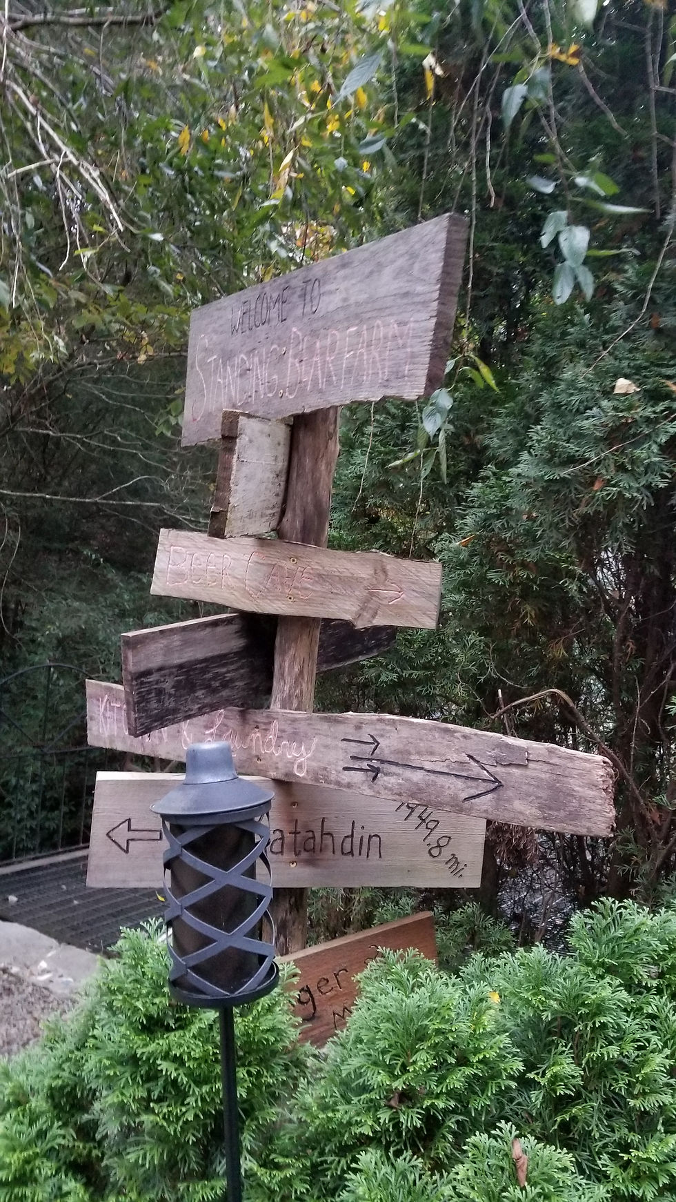
The mileage signs at Standing Bear encouraged us both with the distance from Katahdin and the short balance remaining to Springer

Standing Bear Farm as we head out for the Smokies.

The AT goes down to go up. A steep staircase leads to the I-40 crossing before we start the long climb up the Smokies

Watching people drive by on the freeway reminds me how lucky we are to be hiking rather than working ;)

Beautiful cascades as we enter Smokey Mountain National Park

The Davenport Shelter makes hikers feel like zoo animals - not clear if the fence is to keep thru hikers in or bears out.

This root formed a perfect spout on this small stream making water collection easy

The signs are a bit worn as we navigate the park

For those who have been following our trip, this picture may look familiar. During our hike we had many misty mornings where the sun tried to break through creating eerie scenes

It does make for inspiring trail as we hike into and through sun beams

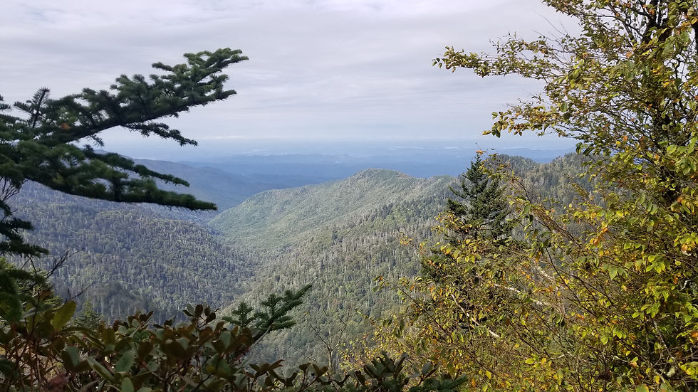
In the Smokies we earned the occasional clear view though most days were overcast or raining

Erik caught me snacking on some Oreos and soaking up the rare sun

Late in the day the sun would finally turn off the fog and mist revealing views of the surrounding mountains

And occasionally the canopy would open to a meadow or bald

A panorama from the ridgeline

Late in the day the clouds settled lower and the higher peaks poked through - Clingmans Dome is the highest point on the AT and coming up for us.

One reason I love being at altitude is seeing things like this
Day 132 - it was COLD this morning. Wind blew and fog came in - much like the Col we camped at in the Bigelows. Wore all my coats and still chilled. Luckily, like Maine, it warmed up a bit and the sun broke through later in the day. We shuttled into Gatlinburg to dry our kit and get a new sleeping pad (my Klymit has leak number 5 and was retired)

The view from Mount Chapman (6,115 feet)

And from Eagle Rock (5,820 feet) - a little better but disappointing to have the Smokies fogged in

The day started clearing as we hit Laurel Top (5,768 feet)
This break in the canopy had me optimistic

But things fogged up again as we looked over the edge of Charlie's Bunion (5,463 feet) a bit further down trail

This is looking back at Charlie's Bunion - a giant rock cliff with great views into the valley below

The fog caused us to miss views in the morning but rewarded us with more cool trail beams later in the day.

It's like a prehistoric forest

As the day wrapped up the sun finally burned through the cloud cover and we were rewarded with this view from Mount Ambler

We exited at Newfound Gap and caught a shuttle into Gatlinburg where we had an awesome dinner, dried out our kit and I was able to get a new sleeping pad

This guy was parked and ready for a snack
Day 133 - today is the big day where we climb Clingman's Dome, the highest point on the AT. It is an 18 mile hike with over 10% grade but we dig into it to get to that peak.

This early view from Mt. Collins (6,155 feet) had us encouraged

However, when we reached the top of Clingman's Dome (6,611 feet) the clouds had completely taken over.

These posters were kind enough to show us what we would be seeing on a clear day . . .

It is cold and windy but we were still excited to be on top of Clingman's

The signs are better maintained near the iconic destinations

Passed this floating island on the way down from Clingman's

After a rugged climb early, the trail leveled out in the afternoon

2000 Miles complete! Giddy up. That is the minimum required for completing an AT thru hike though the full trail is 2,191 miles and we will.hike every one of them.
Day 134 - another foggy and rainy day so we decided to push hard to get to lower altitudes were the cold and wind will abate. Fontana Dam is our goal.

Stood on a pile of rocks to get above the trees and take this shot of the surrounding mountains from the peak of Thunder Mountain (5,522 feet) - thinking of D-land

I loved this view - it's like the creation

It feels like we just entered the Smokies and we are already leaving them. A big 24.1 mile day and we make it to Fontana Dam.

It felt good to see the dam after a long day hiking in the rain. It meant the end was near.

Looking from the dam down to the Little Tennessee river far below

And looking back on the lake side

The dam's spillways were enormous

We stayed at a shelter called the Fontana Hilton with a beautiful lakeside view

Another bizarre looking bug along the trail
Day 135 - we have our last resupply box coming into Stecoah Gap on Thursday so we have two days to cover 15 miles. We split the difference and hike 7.5 miles to the Creekside Paradise on the AT. The host made us a great vegetable lasagna for dinner and we dried out our kit.

Erik outside the Fontana Hilton, a nice shelter on the lake

Another trailside memorial - we each took a pebble with us to Springer

The grade is getting more challenging as we approach Georgia but our trail legs eat it up

We hit the climb up from Fontana Dam hard and took a break at the saddle

Looking back down toward Fontana Lake

This is the largest burl I have ever seen

Seeing a shelter tucked in the woods means snack time is close ;)

Erik moving through the switchbacks
Day 136 - another 7.5 miles takes us to Stecoah Gap and the Wolf Creek Hostel. We get our final resupply box and pack our kit for the final push. It is a sunny day - (what a difference the weather makes.) Enjoying the sunny days as they come.

Some fall colors as we look out from Hogback

Looking toward Georgia and our final destination - getting close

The peak on the horizon is Clingman's Dome, completely clear . . .it is all about the timing
Well, we have 150 miles (about 8-9 days of hiking) left until we finish this epic adventure. Based on that, I expect the next update to be the final chapter we send. It should come from Springer Mountain and the Amicalola Lodge. Until then . . .
Comments