


Arriving in Idaho
- Jun 7, 2022
- 8 min read
There is something significant about exiting your first state when undertaking a long trek. On the AT, it took 3 weeks and 369 miles to finally get out of Maine. On the TAT it took 2 weeks and over 600 miles to get out of Oregon. So, now we tackle the mountains of Idaho on our way to Missoula, Montana.
Day 11 - 69 Miles to John Day, Oregon
What a day. We left the hostel early as we wanted to make the climb before it heated up. The climb was 6 miles up to the pass and there was a headwind to make it even more challenging. We pushed slowly to the top and celebrated with a breakfast of peanut butter burritos. Mmmm. The road then slowly wound down. Today's route was the mirror image of our experience coming into Michell yesterday. Thus, Mitchell is isolated in a pit between these two passes. That explains a lot about Mitchell (Erik compared it to the town in the Cars movie).
Anyway, the trip down today took us through a gorgeous gorgeous and into Daville where we had lunch. At this point we had logged 40 miles and we knew there were thunderstorms coming so we agreed to push on to John Day, another 30 miles away. Made for a long day, but staying dry is a powerful motivator.
It is a little sad to see how many businesses are either closed up or for sale in these small towns. A combination of COVID impacts and people moving away from Oregon (pretty stark contrast between the politics in Portland and the politics in these rural towns). Either way, it is discouraging to experience these small towns dying out.
Outside the towns, things remain beautiful. The farms, woods, rocks and mountains continue to impress.

Mitchell was like the town from Cars - kind of forgotten by all except those who happen upon it accidentally

Why is it having a sign at the top of a climb is so much more satisfying.

The grassy knolls in the background reminds me of New Zealand

Love seeing the snow covered peaks on the horizon

After the climb we dropped into a beautiful gorge with interesting rock formations.


The entrance to this second gorge reminded me of The Gorge near our home in St George

Today's wildflowers

This Pony Express Office is also the US Post Office in Daville

Scenery from Daville to John Day


Is that a hobbit holeon the side of that mound?

An historic farmhouse outside John Day
Day 12 - 56 miles to Sumter, Oregon
The weather and the campgrounds gave us an extreme choice today. We could either go short and camp after 25 miles or we could go long and get to Sumpter. Today is supposed to be dry (until thunderstorms this afternoon) and tomorrow calls for rain all day, and the Warriors play tonight soooo. We decided to push for Sumpter even though it is a second big day in a row and there are three passes between us and Sumpter (over 5 000 feet of climb). The country was gorgeous as we had snow capped peaks looking down on us most of the day. The first climb was 15 miles into the day and after 70 miles yesterday my legs were not happy. We took a break at the summit for peanut butter burritos and then enjoyed the cruise down the backside. Have to admit the backsides are fun when they aren't too steep and there is no traffic. Just lean back and five miles fly by. The second climb seemed endless and I was so glad to finally see the summit. The final climb went by amazingly fast and just as we hit the summit the skies opened up and a thunderstorm erupted. We were 30 minutes from staying dry but were still glad to pull into Sumter for the night. Looking forward to an easier day tomorrow.

On route from John Day to Prairie City

A milestone passed this morning, we have peddled 500 miles

We used to hike the mountains and look down on the valleys, now we bike the valleys and look up at the mountains. Not sure how I feel about that

Not historic, but still cool looking

A morning break in Prairie City, you are looking at the whole thing

We had the snow capped mountains keeping us company all day today

Our first big climb, sometimes it pays to look back

This marker celebrates the Oregon Trail pioneers

5300 feet is a new high for us but only the first of three climbs today

This lush valley sits between our second and third climbs

Today's wildflowers

Day 13 - 30 miles to Baker City, Oregon
Two days of hard work set us up to stay dry and have a better day today. The weather cooperated by raining last night while we were inside and waiting until this afternoon to rain again so we had a sunny morning to ride to Baker City. And, due to all the climb yesterday, today was mostly downhill.
Let me try to describe the perfect morning we had. It's sunny and about 65 degrees. The slope is a gentle downhill. Steep enough you cruise without peddling but not so steep you have to break or worry about speed. We are dropping through a gorge with a river flowing on our right amid towering pines. On the left there are rock formations and cliffs. The downhill stretch runs for 6-7 miles and it's early morning so there is little traffic. That is the scene. So for 15-20 minutes I am sitting in my bucket seat admiring the beauty around me. No peddling, no braking, no worrying just relaxing in the sun and soaking up the beauty of nature. That was our perfect morning. Made the last two days effort worth it.
We cruised into Baker City around 12:30, checked into the hostile and had a BBQ chicken Stromboli for lunch - it was delicious 😋. Next we went in search of a bike shop to work on Erik's breaks. Hoping its a quick fix and we don't need to order or wait for parts. We will see how that and the weather play out for us and then we will write the next chapter. We have two days ride to get from Baker City to Cambridge, Idaho where our resupply boxes await.
Don't know why but I love old barns. Passed this one leaving Sumpter

This one has the snow capped peaks in the background

Eagles Nesting

Can anyone decipher this road sign?

Beautiful scenery as we drop down the canyon into Baker City


The biker hostel we stayed in used to be an elementary school
Day 14 - 54 Miles to Halfway, Oregon
We expected to take a rain day but the weather dried up in the afternoon. So, after a big breakfast at the Eagle Rock Grill we packed our kit and headed out. Further delaying our start, a long freight train was parked across the town. We had to peddle uptown to find an underpass to get past the train. With that problem solved, we finally started our day around noon. The first 40 miles to Richland were basically downhill but at times it felt like uphill, requiring more peddling than expected. We took a snack break in Richland around 4:30 and made the decision to push on to Halfway. The rain hadn't started yet and it was only another 13 miles. That last 13 miles did have a steep climb in it. The climb wasn't easy but we pushed through it and the views were amazing. And, we cruised down the last 5 miles into town arriving at 7:45. Not bad for a late start. The bike legs are slowly coming into form and the climbs are becoming more manageable. Good thing as we head into Hells Canyon next and there are plenty of climbs between here and Missoula. We checked into the Main Street Hotel to stay dry as the rains return tonight. Everything in town was closed so we cooked our dinner in the room (I had lasagna and seafood chowder - both so delicious, thank you Mountain House). When Erik finished cooking his dinner we realized we were out of stove fuel. Would never let that happen as a hiker, got sloppy as a biker. Hoping they have some fuel in Cambridge as there was none in Halfway or Oxbow. Cold soaking Mountain House is not so delicious ans there are not a lot if food options on.this part of the TAT.

Not a promising start to our morning, but cool looking

Passed this awesome Ent on our way out of town

Our exit is blocked by a long train so we peddle a few extra miles to find an
underpass to get around it

Baker City has lots of street sculptures, similar to St George. Nice touch for a downtown area

Great view from the climb we did coming out of Baker City

We passed this cool rock formation
The sound and movement in the video make it even cooler

Excited to head into Hells Canyon

Scenes on our way down from Baker City

Love the strange texture on the hillside


If you look closely, you can see the long switchbacks that represent the climb to end our day

Looking back into the valley as we climb out

Panorama from the top

Passed these guys toward the close of our day

Coming into Halfway
Day 15 - 25 miles to Carter's Landing campsite
We expected to take a rain day based on the weather so we slept in and awoke to sunshine - what? The rain shifted to the afternoon and evening. So, we packed our kit and set off for Oxbow about 17 miles away. The route was gentle and we trekked down another green gorge. We got to Oxbow about 1:30 and it was still sunny so we targeted a campsite about 11 miles away. The terrain started trending upward as we traveled along the lake formed by Oxbow Dam. As we casually trundle along, the skies start darkening and the wind picks up. Up ahead there is a campground that was not on our map. Rather than push the additional 5 miles, we duck into Carter's Landing camp and quickly set up our tents. Not 10 minutes later the thunder booms and the rain starts. We are in our tents by 3 PM staying dry while the rains fall outside. Plenty of time for study and quiet contemplation. Perfect for a Sunday afternoon. My thoughts turn to gratitude. I am grateful for the unique opportunities I have been.given to adventure with my son. I am.grateful for a family that loves me and supports me despite my quirks and bizarre ambitions. I am grateful for the many wonderful friends and coworkers who taught me so much and continue to invest in our relationship. I am grateful I am in this tent as it is nasty outside :). I am grateful for the many tender mercies and blessings that accompany me on this trip. And, my legs are grateful for a short day so they can rest and recover. As we lay in our tents, you can hear the fish jumping out in the lake. Too bad we didnt pack fishing kit. Still, a good way to fall asleep. Until tomorrow when the sun is again shining and we head into Cambridge to get our first resupply boxes.
PS - I just figured out we are still in Oregon. Had we pushed through to the other campsite we would be in Idaho (and very wet). So, Idaho tomorrow

Halfway also has a street sculpture - this one came all the way from Kenya

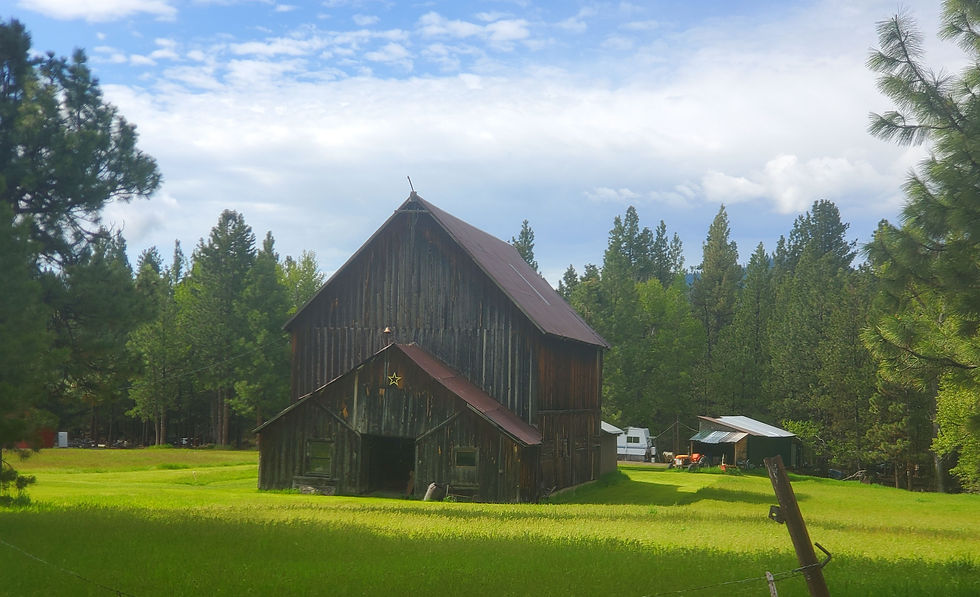
Today's cool barn

Dropping down another gorgeous gorge


If I was hiking rather than biking I would be on that path right there

Everything is so green, a big difference for us desert dwellers

This resevoir made by Brownlee Dam is where we camp tonight

Found some wildflowers by the roadside right before the rain forced us into camp


The hillsides above the resevoir
Your pictures were amazing. What a stunning part of the country. Btw, I don't know about the concept of a peanut butter burrito. I keep thinking of refried beans, guac and peanut butter. I suppose I'm missing something here.
One down ….
I thought of two possibilities for the sign. First, brown is usually a tourist or travel destination, could it be an astronomy viewing area? What seemed more likely was watch for falling boulders or rocks, but who knows really?! The mountains are so beautiful! It’s amazing and awesome your family supports your adventures. I’m glad they do and I’m grateful you share! Living vicariously through you two, Cass